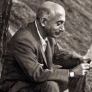
Cartographer (B. 15 May
1912, Istanbul – D. 23 April 1981, Istanbul). He is the son of Ali Rıza Bey, a
quartermaster. During the 1st World War he moved to Damascus from
Istanbul with his family. Upon the death of his father in 1916 and capture of
Damascus by the English troops, he and his mother went to his uncle who lived
as an immigrant in Egypt. After studying for two years in Tanta, upon the
unexpected death of his uncle, he returned to Damascus, to his sister and her
husband. He completed his primary education in 1925 in a model primary school of Muhacirin quarter, whose
director was a Christian Arab. He completed Amber High School in 1931 with an
education of two languages, Arabic and French.
Macit Rıza was not
contented with going to France on behalf of Syrian Government as a scholarship
student and was arrested with students who participated to Syria Liberation
Movement. He was released on probation and returned to Istanbul.
Erbudak graduated from
Istanbul University, Faculty of Science Department of Mathematics in 1935.
Cahit Arf and Ratip Berker were his close school friends. He won the exam
organized by Sümerbank and was sent to Germany in order to have a topographical
engineering education in Berlin. He completed Berlin Engineering Higher School
in 1940. His teacher who was the Director of Potsdam Geodesy Institute, Prof.
Schmehl, received a special permission from his government and led Erbudak to a
PhD. However when he was about to start his PhD, he was called to homeland and
started to work in 1940 in Cartography General Directorate. He completed his
military service of 3 years in General Directorate of Cartography.
Macit Rıza Erbudak
served to prepare the basic regulations, conduct balancing calculations of
horizontal control in Western Anatolia, observation works of Bolu 1st
degree network and for some time in Malaria Control Association of Health
Ministry. After a long expectation in 1945 he entered cartography service of
the bank of provinces as a public officer. He was the only topography engineer
in cartography service of the bank. In 1947 he was assigned to General
Directorate of Land Registers and served there until 1959. He contributed to
the establishment of the faculty, which would raise engineers for land
registration in 1949, and topography and cadaster in 1950. Thus, he added
teaching to his duty of inspection.
He was one of the
founders of İTÜ Cartography-Cadaster Faculty and became associate professor,
professor and dean in this faculty. In 1955 invited by the Swiss Government he
worked in Bern, Basel, Lugano and Zurich for four months. In 1962 invited by
the German Government he stayed in Frankfurt for one and half month and in 1966
invited by Zeiss Jena and Agfa factories in Jena and Stockholm for one month.
He was very cultivated,
had a spiritual and intellectual finesse and a broad tolerance. He could therefore
share people’s sufferings and sadness in their hard times. All the time he
either wrote or read. He dedicated himself to the way he believed in. He was
scared of retiring, and this fear was similar to fear of death.
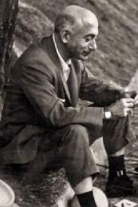
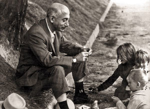
Prof. Macit Rıza Erbudak
who wrote articles about cartography in journals and newspapers is the founder
of cartography profession in Turkey, its teacher and leading applier. After his
death the street in Istanbul / Kadıköy he lived in was given the name
"Prof. Macit Erbudak". Turkish Scientific and Technical Research
Institute also gave him outstanding service award.
MAIN WORKS:
Fiziksel Geodezi (1976), Geodezik Astronomi (1976).
REFERENCE: Prof. Macit Rıza Erbudak’ı Kaybettik (Milliyet, 29 Nisan 1981), İhsan Işık / Ünlü Bilim Adamları (Türkiye Ünlüleri Ansiklopedisi, C. 2, 2013) - Encyclopedia of Turkey’s Famous People (2013).